New version of the Global Atlas for Renewable Energy
IRENA launched a new version of the Global Atlas for Renewable Energy, the online renewable energy mapping platform. For the first time, the platform allows users to download resource data for offline analysis, and to print and export map images.
With these enhancements, the Global Atlas now offers a complete suite of services to support renewable resource mapping and assessment, including an online GIS interface, datasets for five renewable energy technologies that cover every country in the world, online analysis tools, and the ability to export data and maps in several different formats.
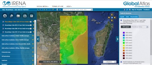
The new version of the Global Atlas also provides a print and export feature, so users can easily incorporate data-rich maps into their publications and presentations. Users can select which data layers and geographic area they are interested in, and then preview and edit a print version of their map before saving it, exporting to Word, or downloading an image file. The download image feature includes a composite image as well as separate image files for each GIS layer.
As an example, you can access Mozambique solar map (Eduardo Mondlane University) (map 1153)

